Coachella Valley Regional Water
Resilience Plan
Coachella Valley Water District (CVWD) has partnered with the Torres Martinez Desert Cahuilla Indians (TMDCI) and Pueblo Unido Community Development Corporation (PUCDC) to develop a Regional Water Resilience Plan (RWRP) for Coachella Valley. This planning effort is funded by the Governor’s Office of Land Use and Climate Innovation, which funds regional climate resilience efforts throughout the State through the Regional Resilience Grant Program. The Leadership Council for Justice and Accountability, the Indio Water Authority, the Coachella Water Authority, the Desert Water Agency, Valley Sanitation District and Mission Springs Water District are all additional partners in this effort.
The purpose of the Coachella Valley RWRP is to equitably address the pressing challenges posed by climate change through a community-based watershed perspective. This plan aims to understand how climate change threatens water resources, ecosystems, and communities in the Coachella Valley. The plan will highlight projects and programs tailored to meet the unique needs of the region, with the goal of reducing the risks posed by drought, flooding, and extreme heat, and strengthening the community’s ability to bounce back when these events occur. Through meaningful engagement of vulnerable communities in the planning and decision-making process, the plan will foster solutions that enhance water security for those most threatened by climate change impacts.
This planning effort will build off various past and existing efforts, including the following regional plans. The RWRP will consider water system and watershed resilience in the context of anticipated climate change hazards.
- 2022 Indio Subbasin Alternative Plan Update
- 2022 Mission Creek Subbasin Alternative Plan Update
- 2019 Coachella Valley IRWM Plan
WHITEWATER RIVER WATERSHED
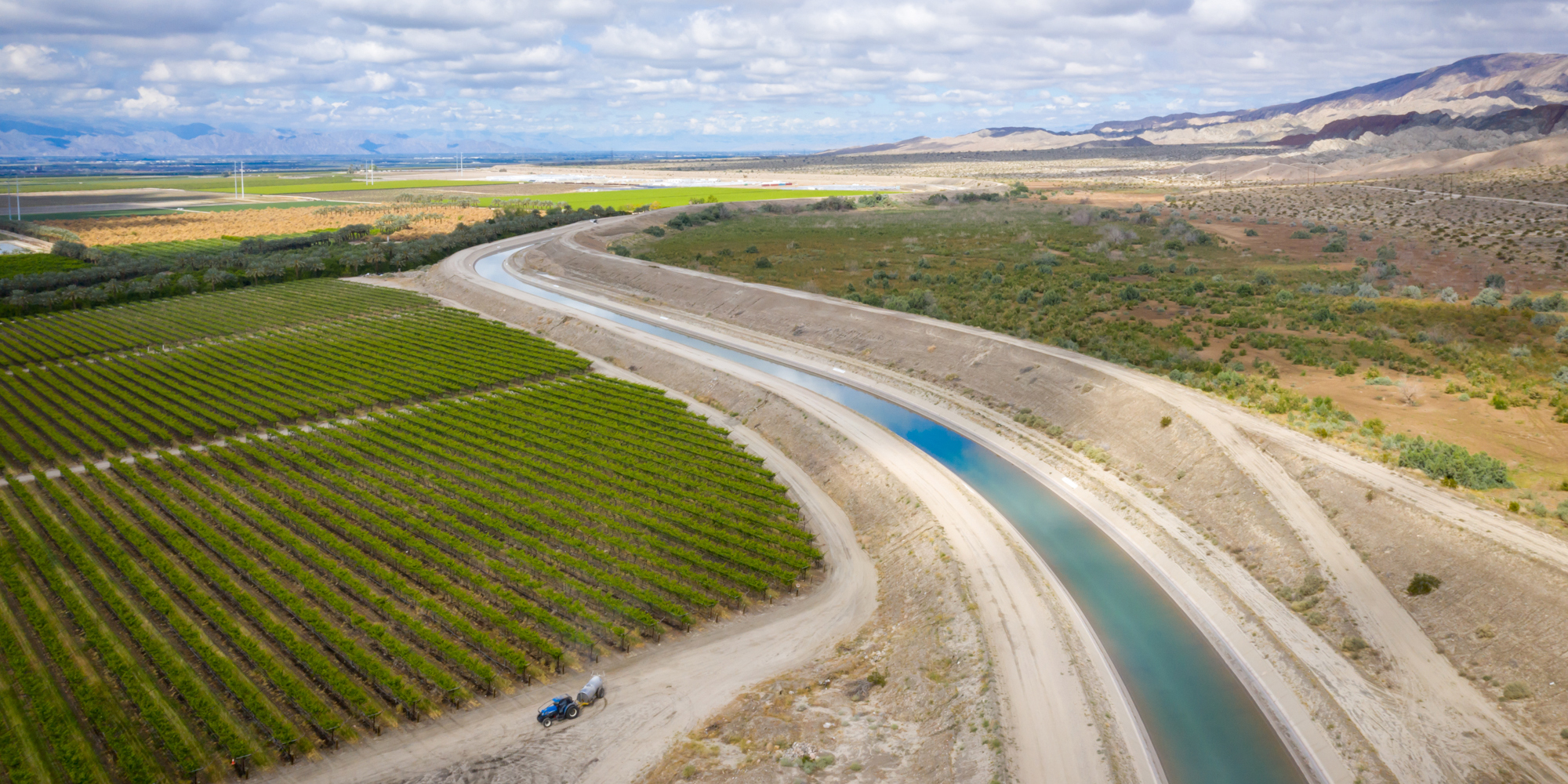
The Whitewater River Watershed, located in Southern California, is an ecologically rich desert environment that begins at Mount San Gorgonio, which stands at 11,499 feet in the San Bernadino Mountains. The river travels over 30 miles, eventually reaching the Coachella Valley. The indigenous people historically associated with the area were the Cahuilla tribe; they relied heavily on the river for sustenance, and have been stewarding the watershed for generations, with their cultural practices deeply intertwined with the river’s ecosystem. This watershed is home to diverse wildlife, including species like the Spotted Owl, Nelson’s Bighorn Sheep, and the Arroyo Toad.
Partners


 Precipitation that falls in the upper watershed percolates through the river bottom into the groundwater aquifer, replenishing the supply in the Coachella Valley Groundwater Basin that sustains the region. This Basin spans from the Whitewater River in the northwest to the Salton Sea in the southeast, consisting of four subbasins. The largest, the Indio (Whitewater) Subbasin, is a key recipient of recharge from precipitation along the upper watershed and mountainfront. However, historically, this natural recharge has not kept pace with groundwater pumping, leading to conditions where groundwater demands exceed long-term supplies, creating imbalances in the water system.
Precipitation that falls in the upper watershed percolates through the river bottom into the groundwater aquifer, replenishing the supply in the Coachella Valley Groundwater Basin that sustains the region. This Basin spans from the Whitewater River in the northwest to the Salton Sea in the southeast, consisting of four subbasins. The largest, the Indio (Whitewater) Subbasin, is a key recipient of recharge from precipitation along the upper watershed and mountainfront. However, historically, this natural recharge has not kept pace with groundwater pumping, leading to conditions where groundwater demands exceed long-term supplies, creating imbalances in the water system.
Cities in the Coachella Valley, including Palm Springs, Coachella, La Quinta, Cathedral City, Rancho Mirage, Palm Desert, Indian Wells, and Indio, and unincorporated communities, primarily depend on groundwater from the Coachella Valley Groundwater Basin for residential and agricultural water needs. Regional water agencies implement groundwater management strategies to prevent overdraft, including importing Colorado River water for groundwater recharge, recycling wastewater for irrigation, and promoting conservation. As the population in these areas grows, the demand for water will increase, making the conservation and protection of the watershed increasingly critical.
The frequency of intense rainfall and flooding has also prompted attention to watershed-based climate planning. On February 14, 2019, heavy rainfall resulted in 3.69 inches of rain at Palm Springs International Airport—the wettest day ever recorded there—leading to widespread closures and water rescues across the valley. In August 2023, Tropical Storm Hilary caused extensive flooding in the region, with Riverside County reporting damages totaling $126 million, marking it as the costliest natural disaster in the county’s history. Projects such as the RWRP are aimed at mitigating these flooding risks, and ensuring that the watershed remains a safe and reliable place to live and thrive for surrounding communities.